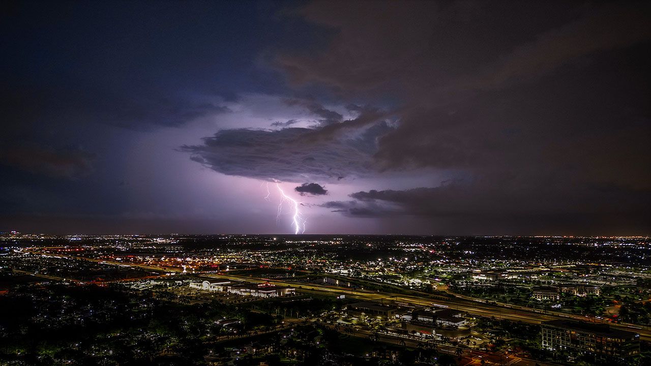


Strong to severe thunderstorms are expected to move across Wisconsin Thursday afternoon and evening ahead of a cold front that will cross the state.
Expect a quiet start to the day on Thursday with some morning fog close to Lake Michigan and morning temperatures in the 50s and 60s. Throughout the morning, fog will lift and temperatures will climb with afternoon highs soaring into the 70s and 80s.
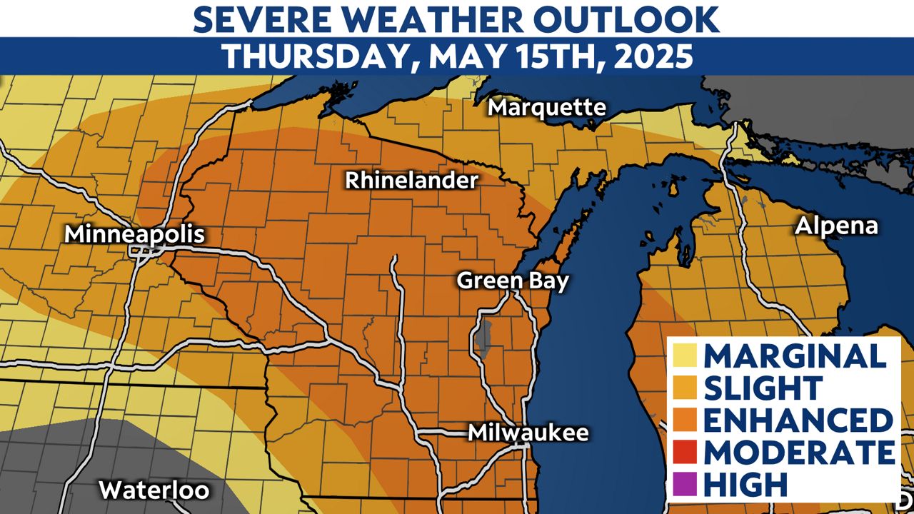
The risk of severe weather is elevated across Wisconsin with much of the state considered to be in an "Enhanced Risk" for severe weather. This means numerous severe thunderstorms are possible, with the potential for widespread storms, a few of which may be intense.
The atmosphere will become unstable behind a warm front and ahead of an advancing cold front through the morning and early afternoon. Thunderstorms will begin to develop across western Wisconsin in the early afternoon hours and individual thunderstorm cells will likely form into bowing line segments as they progress northeast across the state.

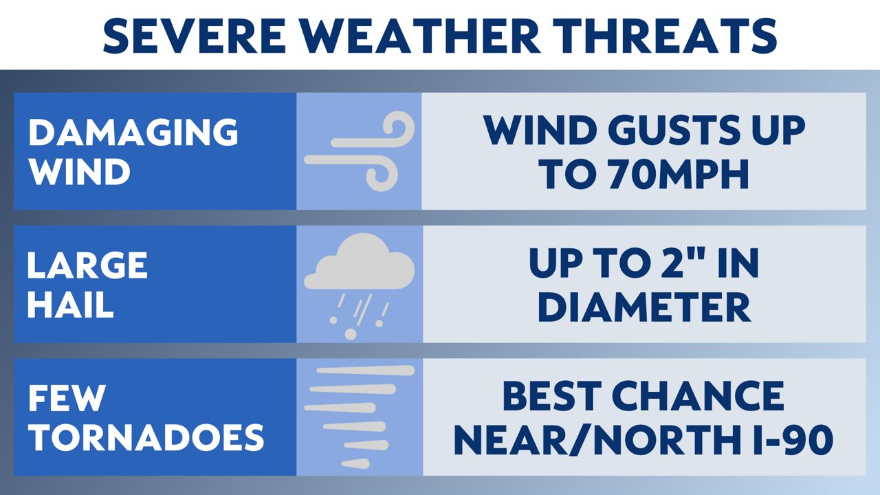
The window for peak storm intensity is from 4 p.m. to 8 p.m. Thursday. During this time, all weather hazards will be possible including large hail around 2 inches in diameter (roughly the size of a hen egg) or larger, damaging wind gusts up to 70 mph, and a few tornadoes, some of which may be strong. The areas most at-risk of seeing severe thunderstorm activity will be north of U.S. 18 with the highest chance of seeing storms capable of producing tornadoes near or north of I-90.
Because these storms will be moving quickly, flooding is not expected to be an issue, but brief periods of heavy rain will be possible at times.
After 8 p.m., the storms will reach more stable air near Lake Michigan and eventually push out over the lake with the severe weather threat ending.
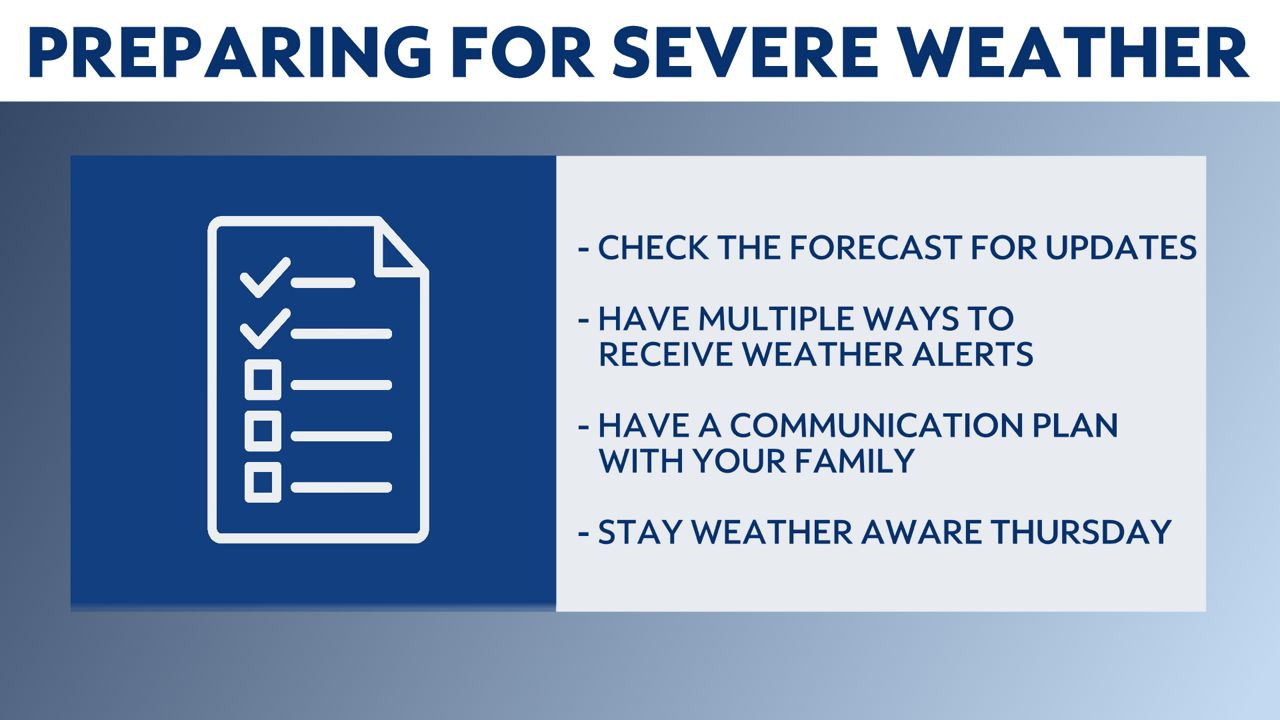
Preparation is key ahead of severe weather and there are a few things you can do to make sure you and your family are ready when severe weather strikes. Check the forecast for weather updates and changes on Thursday. As an event draws closer, weather models become more accurate and we are able to fine-tune more details.
Have multiple ways to receive weather alerts, especially if you are planning on being out and about during the afternoon and evening hours.
Be sure to discuss a communication plan with your family and include things like where to go in the event of a tornado, a possible meeting location in the event of an emergency, and any related or important information.
Stay weather aware on Thursday and always pay attention to changing weather conditions.
Your "Weather On The 1s" Team will provide updates on-air and online through Thursday. Stay with Spectrum News 1 Wisconsin as we continue to track the severe weather threat.
Check your local forecast | Send us your weather photos
Follow the "Weather On the 1s" Team on social media for the latest weather updates:
Meteorologist Brooke Brighton: Facebook | Twitter | Instagram | Threads l Bluesky
Meteorologist Jesse Gunkel: Facebook | Twitter
Meteorologist Kristin Ketchell: Facebook | Twitter | Instagram