


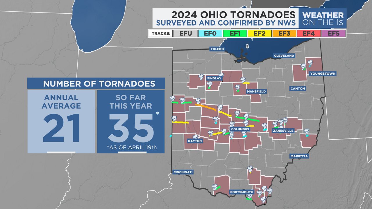
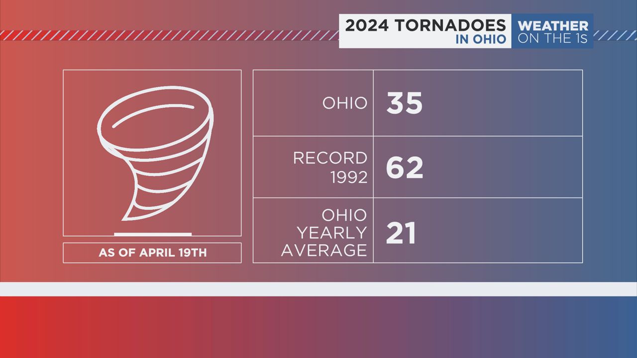
OHIO — As of April 19, Ohio has recorded 35 tornado touchdowns since the beginning of the year, according to data released Friday from the National Weather Service.
Severe weather season got off to a quick start with the first nine tornadoes recorded on Feb. 28.
Then, on March 5, a brief landspout tornado touched down in a field in northwest Ohio.
On March 14, another outbreak of nine tornadoes ripped across western and central Ohio with a deadly EF3 tornado recorded in Lakeview.
Just about two weeks later, 11 more tornadoes were confirmed from a series of storms that cross the Buckeye State on April 2.
Finally, just this week on Wednesday, five more touched down.
Most tornadoes in Ohio occur between April and June
The pattern we have seen since late February is for severe storms to threaten Ohio about every 2 weeks or so.
In 2023, we saw a similar active pattern. By the time the year was over, the state reported 56 tornadoes.
The most tornadoes to occur in a year on record was in 1992, when 62 tornadoes ripped across the state.
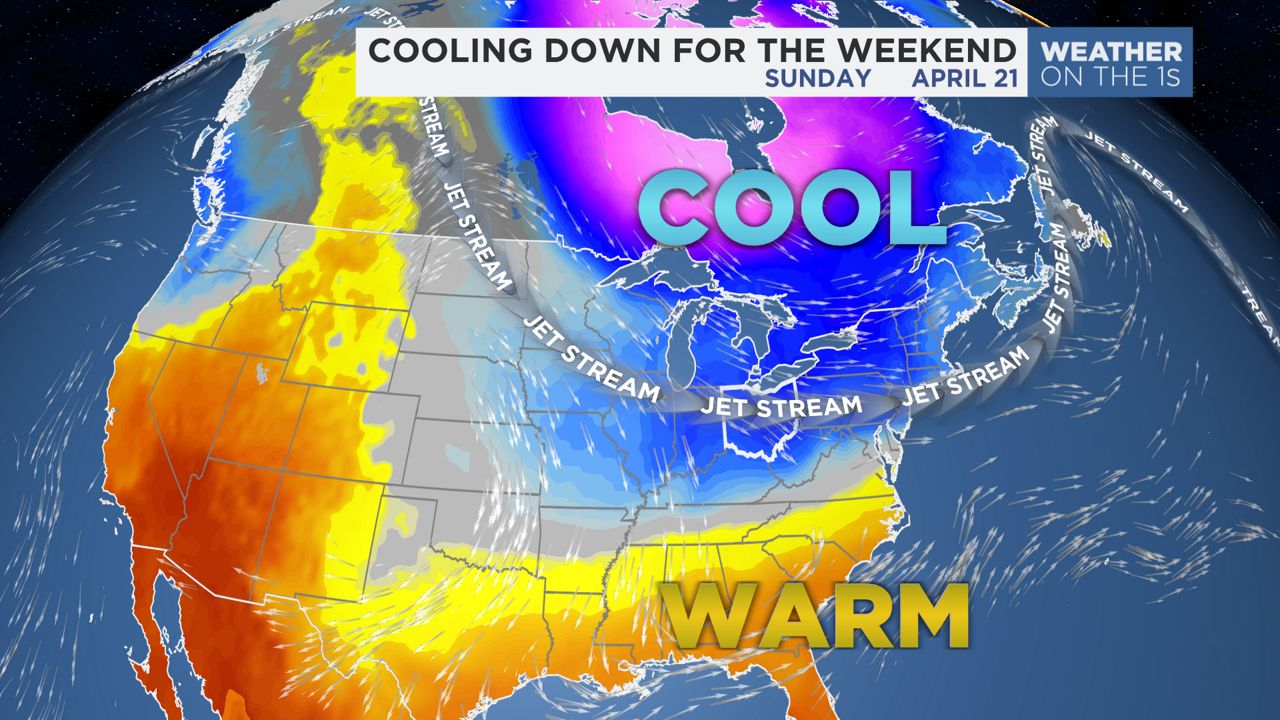
The forecast calls for a brief break in the pattern after this past week's severe storms. A trough in the jet stream is setting up across the Great Lakes and across much of the northeastern United States.
This will keep near or below normal temperatures across the state likely for the next six to eight days. Such a pattern is typically not conducive to severe storms.
As to the reason we've seen such a fast start to severe weather season, our team of meteorologists blame the El Niño weather pattern we've been under throughout the winter.
El Niño refers to a warming of the ocean surface, or above-average sea surface temperatures, in the central and eastern tropical Pacific Ocean.
This pattern has been responsible for the milder than average winter with much less snow than normal. This pattern has continued into the Spring.
Because of such mild air, the ingredients for severe storms have come together much earlier in the year than normal.
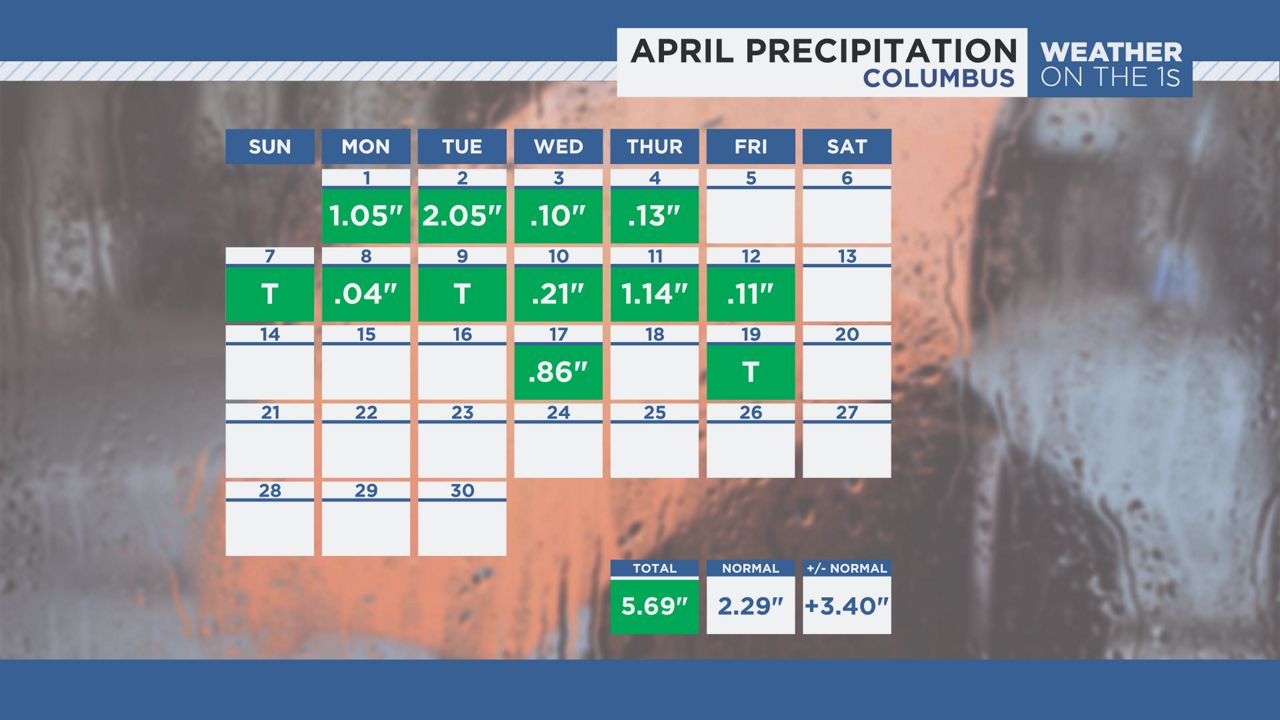
It is also keeping our storm track active with numerous systems fueling off of the unseasonably warm temperatures and increased moisture amounts. The pattern has produced rainfall amounts that are well over an inch above normal for the month in most cities in Ohio, with most measuring rainfall 11 to 14 days out of the first 19 days of the month.
The El Niño pattern is likely to slowly weaken over the coming weeks. Meteorologists are seeing signs that the opposite weather pattern called La Niña will likely develop as we head into the summer.
It is unclear if the pattern change will help slow Ohio's severe weather season, however, as La Niña typically brings active weather in our region.
This pattern could also bring about more average to slightly above average temperatures in the summer months.
Our team of meteorologists dives deep into the science of weather and breaks down timely weather data and information. To view more weather and climate stories, check out our weather blogs section.