


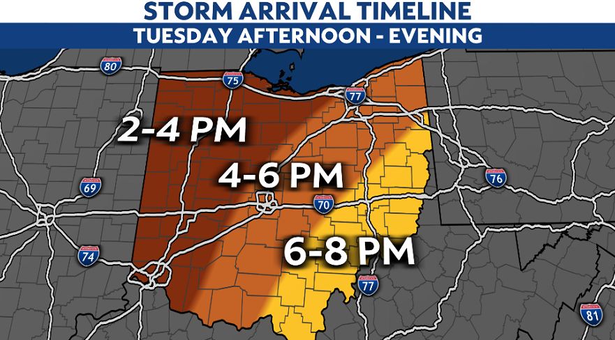
OHIO — Some showers, few storms possible before our main wave later Tuesday. It's a statewide risk for severe weather as a cold front approaches the Ohio Valley.
Severe storms are capable of producing damaging winds up to 70 mph, along with isolated tornadoes and hail.
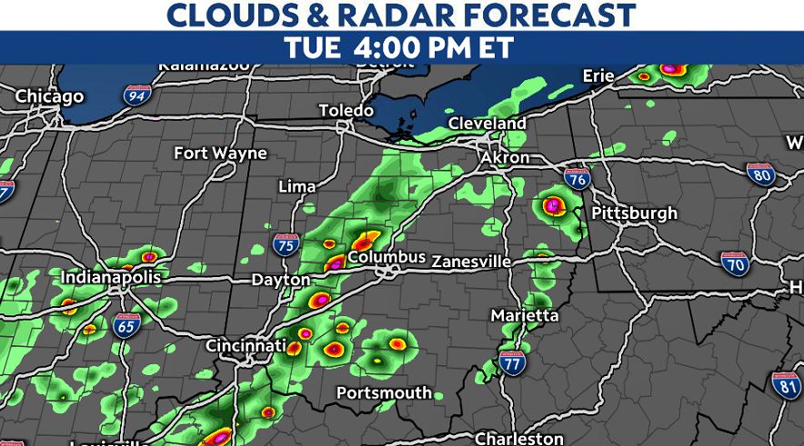
Due to the warmth from Monday and again today, we'll have some instability in the atmosphere as a cold front is forecasted to move through by tonight.
These fast-moving storms will enter western Ohio early-mid afternoon then race toward eastern Ohio by dinner time.
Be weather ready for storms to quickly impact your evening commute with downpours and gusty winds.
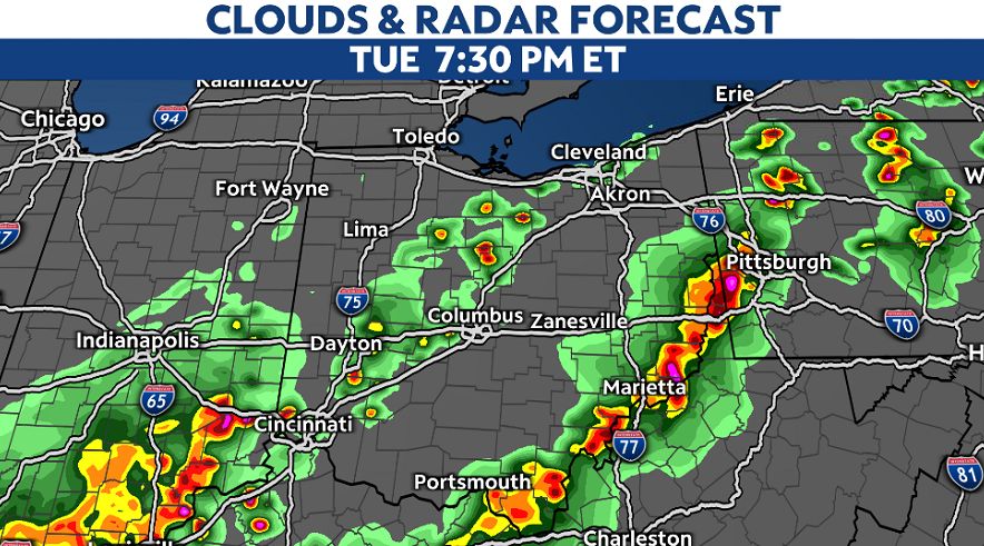
Severe weather remains possible through the late evening, so we don't need to worry about warnings overnight as our severe weather threat is more unlikely after sundown.
Storms should weaken as we lose the daytime heating of the day, between 9 p.m. and 10 p.m.
)
Temperatures quickly fall in parts of northern Ohio as lows Wednesday morning bottom out near 40. The rest of the state drops into the 50s, becoming cooler for Wednesday as skies look quieter for most.
More active weather returns late week and is on/off into the start of the weekend.