


BUTLER COUNTY, Ohio—For four hours straight, a computer with a map was the only thing dozens of Miami University students were seeing.
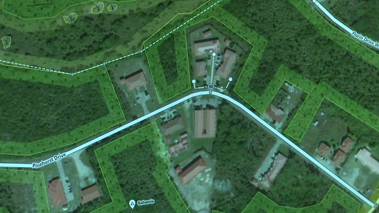
- Students from Miami University’s geology department took to a computer and spent four straight hours mapping the Bahamas
- They mapped out and reconstructed what the area is supposed to look like before the hurricane destroyed it
- Rescue crews used the maps to find roads that once stood and people who are still missing
Tessa Farthing was one of them.
“What we’re trying to do is reconstruct what was there before, so kinda going back in time,” said Farthing.
The maps are old satellite images showing what the Bahamas looked like before the hurricane hit.
Students marked streets and buildings, and the maps went straight to crews on the ground in the Bahamas so they could find what or who is missing.
“A lot of that data was being pulled on very fast for the international rescue efforts that landed, including the U.S. Coast Guard,” said Robbyn Abbitt, GIS coordinator.
It’s what they called a Mapathon, to get the maps out quickly to rescuers.
The university’s GIS coordinator says it’s something that’s never been done before for the Bahamas, but now they have a snapshot of a lot of the islands.
“A total of about 9,000 buildings and 1,500 roads were mapped in just the two islands of Abaco and Grand Bahama,” said Abbitt.
It’s an effort that has also helped in the hurricane recovery in Puerto Rico, and something students say they’d do all over again.
“It makes you realize what you’re doing could make a really really big difference in the world,” said Farthing.